A new atlas developed as a result of collaboration between Alberta Environment and Water and the Alberta Geological Survey will give a better understanding of the groundwater resources between Edmonton and Calgary.
The study is to ensure that the provincial government can implement policies and actions to manage groundwater in a sustainable manner.
“The goal is to quantify how much groundwater is in an area such as Drumheller,” said Steve Wallace, a groundwater policy specialist. “We also want to predict whether groundwater use at the current rate is sustainable and whether use can increase.”
The atlas covers groundwater features in the region and includes the results of airborne geophysical surveys in the Edmonton-Calgary corridor, which includes Drumheller.
An electromagnetic pulse is emitted at the ground from a research plane. Depending on the properties of the ground, the pulse will be absorbed or reflected. A receiver in tow by the plane collects the reflected energy.
Based on the response that the receiver gets, it is possible to determine the type of rocks, the layer sequence of the rocks, and the conductivity of the rocks. Less resistant rocks, such as shale or clays, generally do not hold water. High conductivity rocks, such as sandstone, hold more water.
Afterwards, the data collected is combined with existing information, such as drilling reports, to give clearer insight about the distribution of groundwater.
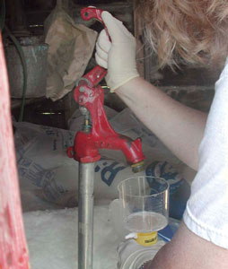
Another aspect of the project was investigating the chemical composition of groundwater in various areas through well sampling.
“The natural quality of the water has been characterized,” said Wallace. “It would help users understand what kind of water quality they have and help determine what the water could be used for.”
The results of the study show that groundwater resources in the Drumheller area are widespread and of good quality. The sensitivity of groundwater in the Drumheller area to land use, such as a spill, is quite low due to the composition of the rock layers.
The next step is to quantify the water held in aquifers in the study area, including the area around Drumheller.
“Preliminary investigations indicate there are no warning flags in the area,” said Wallace. “The data would help us nail down what sustainable groundwater use would be in the Drumheller area.”
The atlas is available online at www.alberta.ca/NewsFrame.