A number of towns in the area are getting a new look when it comes to aerial photography.
Not only are the recent aerial photographs of these towns the traditional overhead view, they’re also taken at a forty-five degree angle for a more complete picture.
Justin Hill, GIS Coordinator with Palliser Regional Municipal Services, co-ordianted the project.
Palliser is an organization owned by a number of municipalities, including Drumheller and Starland County, and these photographs will be used for municipal planning, such as a new subdivision; municipal asset tracking, such as locating a fire hydrant; and by attaching them to their real world coordinates, mapping purposes.
And residents can check out the assessment on their house.
Hill said the oblique angle photography was flown for Castor, Coronation, Drumheller, Hanna, Oyen and Trochu.
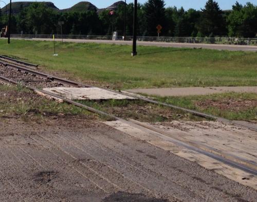
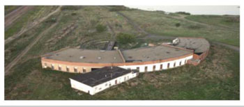
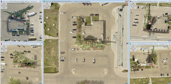
That means these towns will have aerial photographs not only from the traditional overhead view, but will also have photographs that show the north, south, east and west sides of a building or structure, such as the World’s Largest Dinosaur as shown in the photographs above.
Hill said there are benefits of having photographs at these angles for both homeowners, in being able to view their homes, and municipalities, especially when it comes to planning.
Another improvement over the last set of aerial photographs for the area from 2007 said Hill, is the resolution of the photography.
The previous aerial photography was taken at a 30 centimetre (cm) resolution.
“While it’s good, it’s just not super accurate for being able to pick out some of the ground features,” said Hill.
Twenty-two municipalities were flown to update their aerial photographs.
The large rural areas are still photographed at 30 cm, and Hill said the crew flew a little bit lower and got an 8 cm distance for the town of Drumheller, but a number of towns and villages have been photographed at the 10 cm resolution.
That means that one pixel in the aerial photo relates to 10 cm on the ground.
“The information that it gives us and the possibilities that it gives us are really far reaching - there’s a lot of different applications,” Hill said of the higher resolution photos.
He said the imagery is so crisp that things such as manhole covers and fire hydrants can be picked out of the photographs.
And that’s one of the benefits of the higher resolution photos - to assist municipalities with asset tracking, as well as verifying previous surveys.
“There’s not just images, there’s also a lot of supplementary information we can get off the images.”
“One of the things most important, especially with the Drumheller area,” he said, “is elevation data.”
He notes that means a really accurate contour map of the entire valley can be made.
“And when we’re looking at some of the issues that Drumheller faced last year with flooding and that type of thing, and flood mitigation, that elevation is really important.”
Hill said another driving force behind this project is development of the website
palliserwebmap.ca.
While there’s an area for municipalities to log on, there’s also a public access button, so anyone is able to go onto the site and view the aerial images.
There are tourism and recreation maps to view, with people being able to select a specific site, such as the Atlas Coal Mine or a specific golf course.
The imagery includes a number of recreation sites in the region, including swimming pools and campgrounds.
Hill said Palliser’s goal is to get the new aerial imagery onto palliserwebmap.ca by the beginning of September, if not sooner.
He said the aerial photography project started in earnest last fall to get the grant funding in place.
As a result, a good portion of the project funding is provided in the form of a regional collaboration grant through Alberta Municipal Affairs.