Drumheller residents may be seeing a different type of aircraft flying over the Valley in the next few months.
Palliser Regional Municipal Services Ltd. will be bringing their drone to do some modeling of the valley to help with flood mitigation. The Drone is called the Sense Fly Ebee Real Time Kinetics unit.
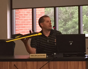
Justin Hill, GIS coordinator for Palliser said, “It is a fixed wing mapping drone that uses GPS technology, both on the ground and in the sky and it has real time links between the two in order to provide survey grade accurate mapping.”
The drone is able to cover a “large amount of area in a short amount of time,” Hill said continuing by saying that the accuracy is “flexible. You can adjust it based on what you want to get. Pixel accuracy is more or less determined by the elevation of the drone, so we can control the elevation of the drone at which it flies. Typically we will fly at about 95 metres above ground level, which will give us about two and a half centimeter resolution. We can fly higher and we can even fly a little bit lower to get a bit tighter imagery as well.”
At the regular council meeting on Monday June 29 Hill said the hope is to improve the mapping that is available for flood mitigation in Drumheller.
“We want to fly all the areas around the river valley, and get a really good look and a three dimensional model built up of all the berms and dykes and the flood mitigation system around the town of Drumheller and really be able to improve the mapping that we have for that capabilities,” Hill explained.
He said there are a lot of different applications that are in mind for the drone. “Not only are we able to do this three dimensional mapping for flood mitigation, we are able to do two dimensional photography, we are able to produce three dimensional areas of things like stock piles, gravel pits, produce volume calculations, there are a number of different aspects.
The drone cost, Hill said, was “in the neighbourhood of $60,000 just for the drone itself, and then the survey bay station equipment would add a little bit more to that as well.”
Drumheller Mayor Terry Yemen said this Drone is a good example of new technology.
“It is quite remarkable what they can do and it certainly comes with a huge cost savings for the Town of Drumheller,” he said continuing by saying that it use to be very costly to take aerial shots of the Valley but now they can do that for less.