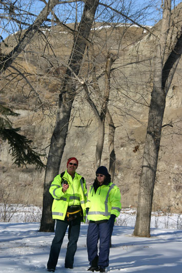
Members of Badlands Search and Rescue Merv Smith, left, with Joan Cormier, practice their GPS navigation training near the Red Deer River Saturday, February 21.
Members of the Drumheller based Badlands Search and Rescue were at the Badlands Community Facility for a day of GPS (Global Positioning System) training Saturday, February 21.
“It’s all about navigation, so when we send searchers out, they know how to get to the search area, and we know their location,” said Training Coordinator Guy Latour.
Latour said when searchers locate missing persons, GPS is used 99 per cent of the time to bring emergency responders to the find location.
The searchers took part in classroom training, then headed out under a blue sky and minus 16 wind chill for their field training.
The GPS navigation training allows searchers to mark their base location and learn way points to find their way around using the GPS system.
Searches headed out for an initial practice run, starting and returning to the BCF, then had ten practice locations over a five kilometre area along the Red Deer River and Riverside Drive.
The Global Positioning System (GPS) is a world-wide radio-navigation system formed from a group of 24 satellites and their ground stations.
Badlands Search and Rescue began operations about three years ago.