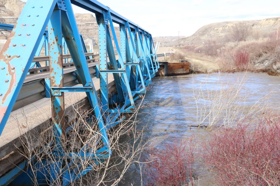
The bridge on the Dunphy Road has been closed as Kneehill County continues to deal with the high water event throughout the county.
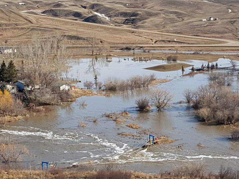
An Information alert in the County for Overland Flooding was issued on Alberta Emergency Alert on Sunday, April 22 and it continues today. Melting snow has led to overland flooding throughout the county.
Currently, the bridge on Range Road 21-2A, the Dunphy road, has been closed to traffic. Residents in the area must access the community from Highway 575 at the top of the Carbon Hill
The are number of current road closures, and if residents are aware of an affected roadway that has not been flagged, they can contact the County office at 1-866-443-5541, or email office@kneehillcounty.com
ROAD CLOSURES as of 2:30 pm, April 25, 2018
1. RE-OPENED April 25 at 2:00 pm: Rge Rd 23-3 between Hwy 583 and Twp Rd 32-2
2. RE-OPENED April 23 at 9:00 am: Rge Rd 24-0 between Hwy 27 and Twp Rd 32-4
3. RE-OPENED April 23 at 10:00 am: Rge Rd 26-0 between Hwy 27 and Twp Rd 33-2
4. Twp Rd 32-5A between Hwy 805 & Railway Ave in Torrington (south leaving Torrington back to Hwy 805)
5. Rge Rd 26-2 south of Hwy 582 road closed due to overland flooding
6. Twp Rd 33-4 between Rge Rd 23-1 and 23-3 due to Ghost Pine Creek flooding its banks
7. RE-OPENED April 24 at 11:30 am:Twp Rd 33-2 between Rge Rd 25-4 & 25-5
8. Twp Rd 34-0 between Rge Rd 25-3 and 25-2 (Bigelow Dam)
9. Rge Rd 25-0 between Twp Rd 32-5 & Twp Rd 32-4 due to rushing water crossing this road.
10. Twp Rd 32-3 between Rge Rd 25-0 & Rge Rd 24-4 due to rushing water crossing this road (resident has access from Rge Rd 24-4 heading west to approach)
11. Rge Rd 26-4 between Twp Rd 32-2 and Hwy 27
12. Twp Rd 33-4 between Rge Rd 25-0 and Rge Rd 25-1 due to flooding from Three Hills Creek
13. RE-OPENED April 25 at 8:00 am: Rge Rd 24-3 south of Hwy 583 to Twp Rd 31-4
14. Twp Rd 33-4A between Rge Rd 23-4 & 23-3 flooding occurring in the mine flats (resident has access from Twp Rd 33-4 heading east to approach)
15. RE-OPENED April 25 at 2:00 pm: Twp Rd 31-0 between Rge Rd 23-4 & Hwy 21
16. RE-OPENED April 24 at 11:30 am: Twp 33-2 between Rge Rd 26-4 & 26-5
17. Re-OPENED April 25 at 2:00 pm: Rge Rd 24-5 between Twp Rd 34-4 & 35-0
18. Rge Rd 23-1 between Twp Rd 28-4 & 29-0 due to flooding
19. RE-OPENED April 25 at 2:00 pm: Rge Rd 24-4 between Twp Rd 35-0 & 34-4
20. RE-OPENED April 25 at 2:00 pm: Rng Rd 24-2 between Twp Rd 31-4 & Hwy 582
21. RE-OPENED April 25 at 2:00 pm: Rge Rd 24-2 south of Twp Rd 30-2 (Swalwell Highway)
22. RE-OPENED April 25 at 2:00 pm: Twp Rd 29-0 between Rge 25-2 & 25-3
23. RE-OPENED April 25 at 2:00 pm: Rge 25-2 (Bircham Rd) south of Twp 29-4 (Hwy 575)
24. Twp 29-0 between Rge 26-0 & 26-1 due to flooding
25. Twp 29-2 between Rge 26-0 & 25-5 due to flooding
26. RE-OPENED April 24 at 12:30 pm: Twp Rd 29-2 between Rge Rd 26-2 & Rge Rd 26-3
27. Rge Rd 21-1A Dunphy Rd between Hwy 575 & Rge Rd 21-2A bridge closed due to flooding.
28. Rge Rd 25-1 between Twp 31-4 and Hwy 582.
29. Rge Rd 24-4 north of Hwy 583
30. Rge Rd 25-4 between Twp Rd 33-2 & 33-4
Local Traffic Only:
Flooding with water ponding on roadway these areas are flagged but not closed yet:
- Rge Rd 26-1 between Hwy 587 & Twp Rd 34-4 flooding occurring approx. 1/2mile south of Hwy 587. Resident has access from Twp 34-4 heading south to approach.
- Rge Rd 23-4 between Hwy 585 & Twp Rd 33-0 St. Anne Ranch Road is seeing water on roadway.
- Rg Rd 25-1 north of Hwy 587 for approximately 1.5 miles.
Valleys roadways update:
- Rge Rd 21-2 between Twp Rd 28-0 & Rosebud River boundary: seeing washouts along both sides of this roadway heading down into the Rosebud Valley. We have a crew heading this way to repair damage this morning – Local traffic only
- Rge Rd 21-2A between Twp Rd 29-3A & Rge Rd 21-1A Dunphy Hill seeing washouts mainly on east side of roadway. Crews repaired this area yesterday, however we continue to assess this area throughout the weekend.
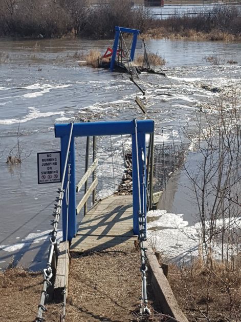
- Rge Rd 21-1A Dunphy Rd – a section of this road is down to 1 lane area, please avoid this roadway if possible.
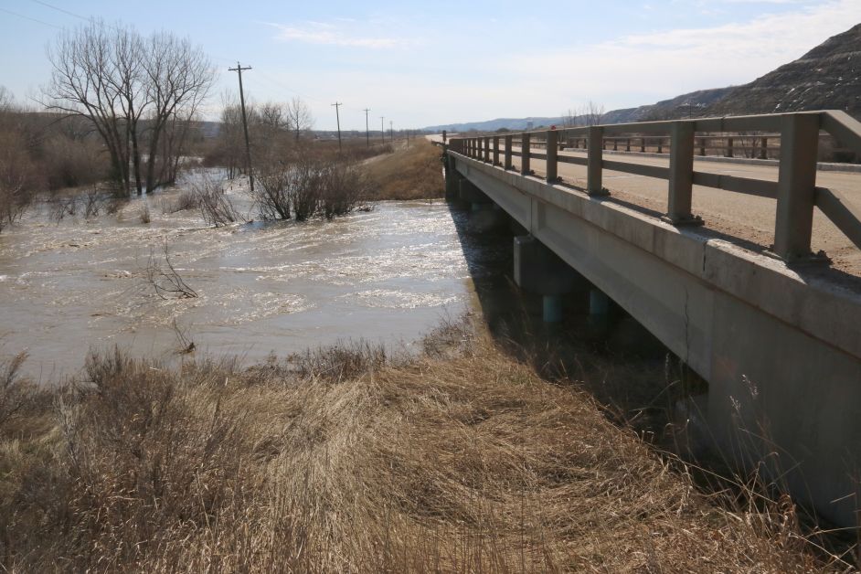
Please do not drive through water running across roads.
Creeks and other waterways have high water volumes and water is moving quickly. Please stay back from banks that may be unstable.