Before much of the flood mitigation efforts go forward, there needs to be assessments and approvals to protect the river, and the life it supports.
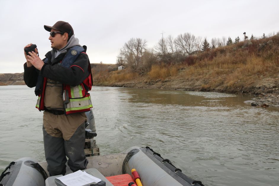
Some of these efforts are underway and last week aquatic biologist Michael Kovacs of Wood Environmental and Infrastructure Solutions was on the river to assess the aquatic terrain.
Chief Flood Mitigation and Resiliency officer Darwin Durnie explains these assessments have to be done before work can proceed.
“Areas we might have to disturb for armouring or rip rap, and diking, we have to look at what we disturb from terrestrial and aquatic perspective,” he said.
“We need a Qualified Aquatic Environmental Specialist (QAES) to determine what that impact might be and whether what we plan to do is acceptable, or if we have to do mitigation efforts,” said Durnie. “Also, in the same zone on the land, we do the terrestrial and animal inventory.”
These include taking stock of the plant and animal life along the river and its habitat.
“We have been doing that on all 100 kilometres of the bank along the river trying to figure out what is where, so we can figure out, if anything, we have to design around,” he said
Kovacs explains the project will need approval under the Water Act as well as Fisheries and Oceans. With a river like the Red Deer River, there is quite a bit of historical data to rely on in terms of fish populations.
Kovacs was joined by Darrell Berlando as they worked last week transecting the river, taking measurements of the width of the river from the wetted edge, to the one-in-two-year high watermark and the top of bank. He also records the depths and categorizes the habitat, noting physical features. This will give them an idea of where they can add flood mitigation measures, or take measures where habitat is displaced. One example is planting trees near the river to create root clusters that can act as cover for some species of fish to live or forage.
On Friday, they were working along the river near Cambria and were working towards East Coulee. These assessments have to be completed in areas where there may be disturbance, and downstream in the zone of influence.